During our stay at Kartchner Caverns State Park, we took a day to visit Fort Bowie National Historic Site near Willcox, Arizona. This National Park Unit preserves the ruins of Fort Bowie and Apache Pass, a location critical to western expansion in the mid-late 1800s and the most contested area during the Apache Wars. Today, this area that was once the scene of so much violence is a peaceful location off a little-traveled dirt road. Few people have heard of Fort Bowie, but for National Park and American History enthusiasts (like me!), it is a must-see.
History of Apache Pass
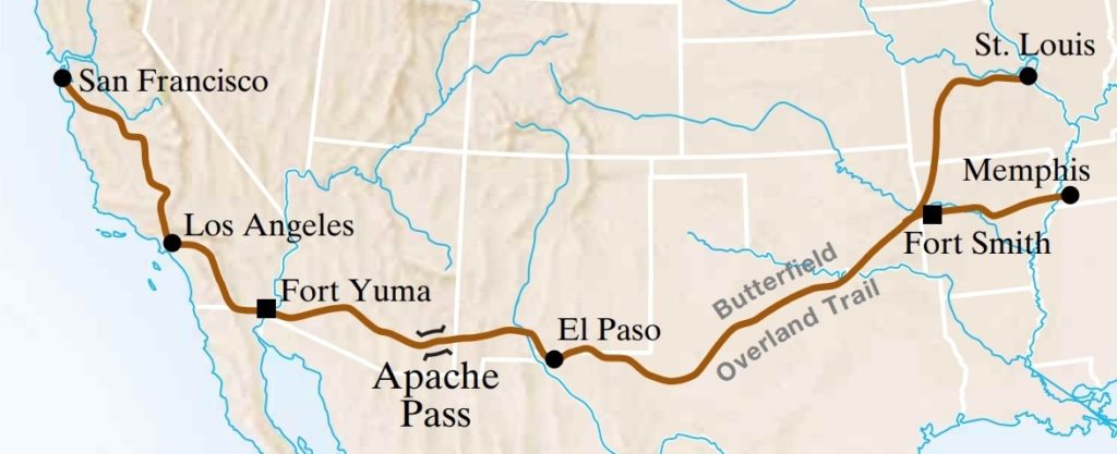
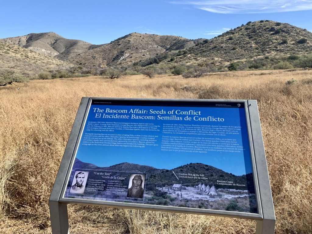
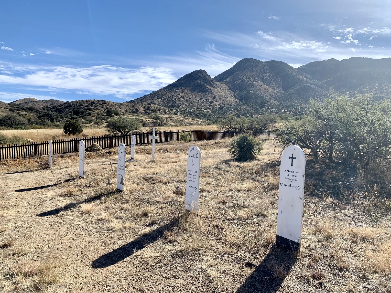
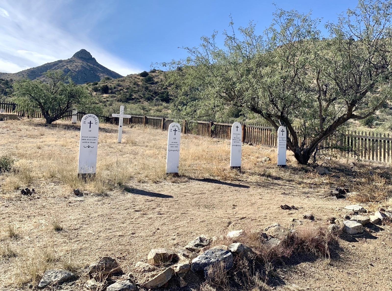
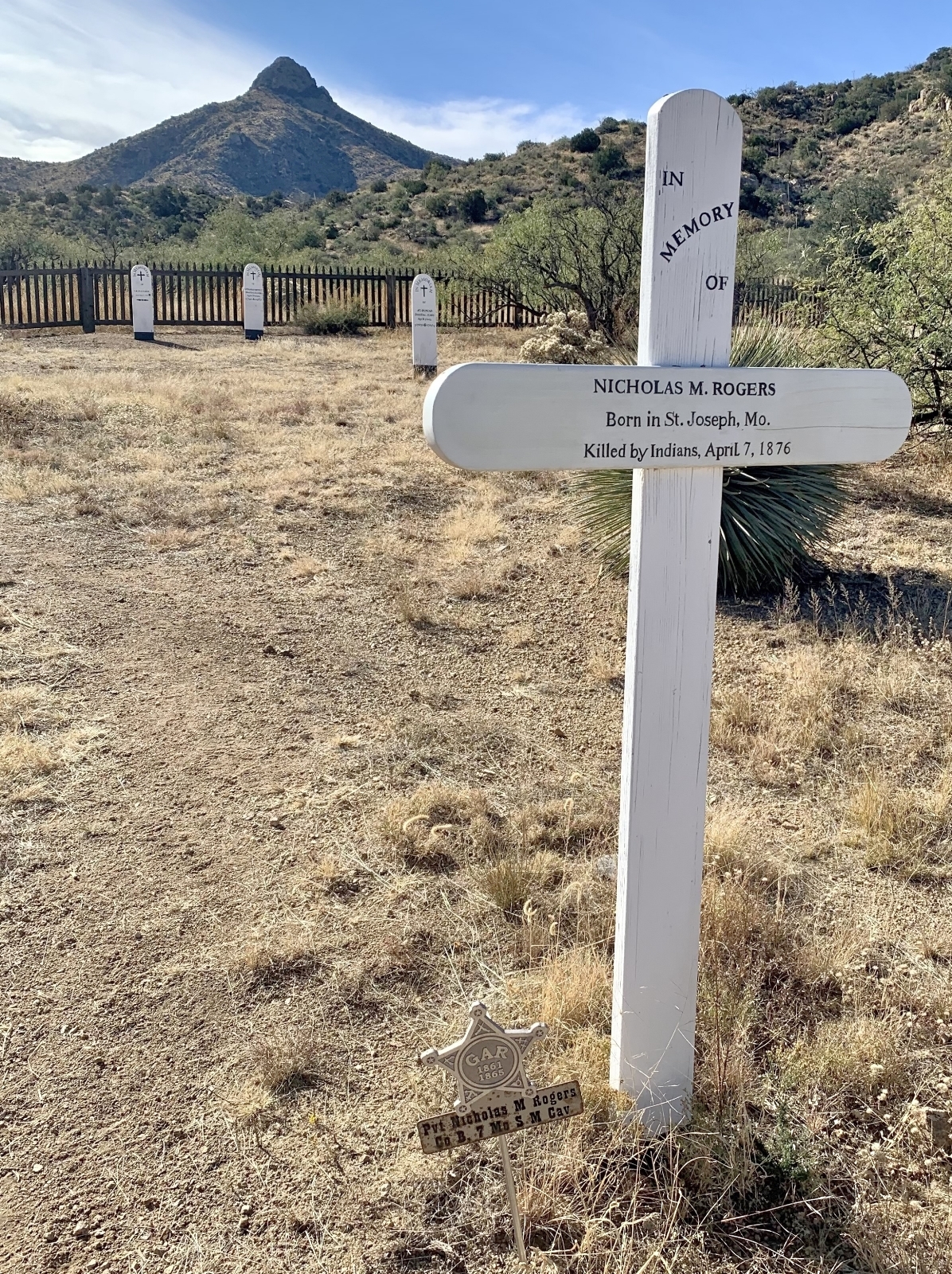
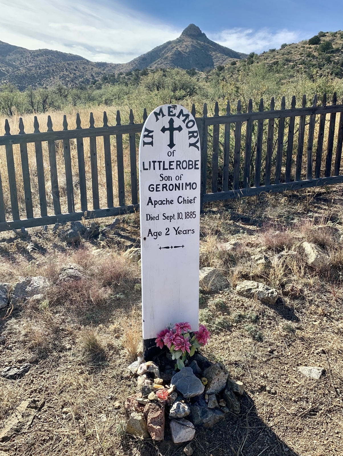
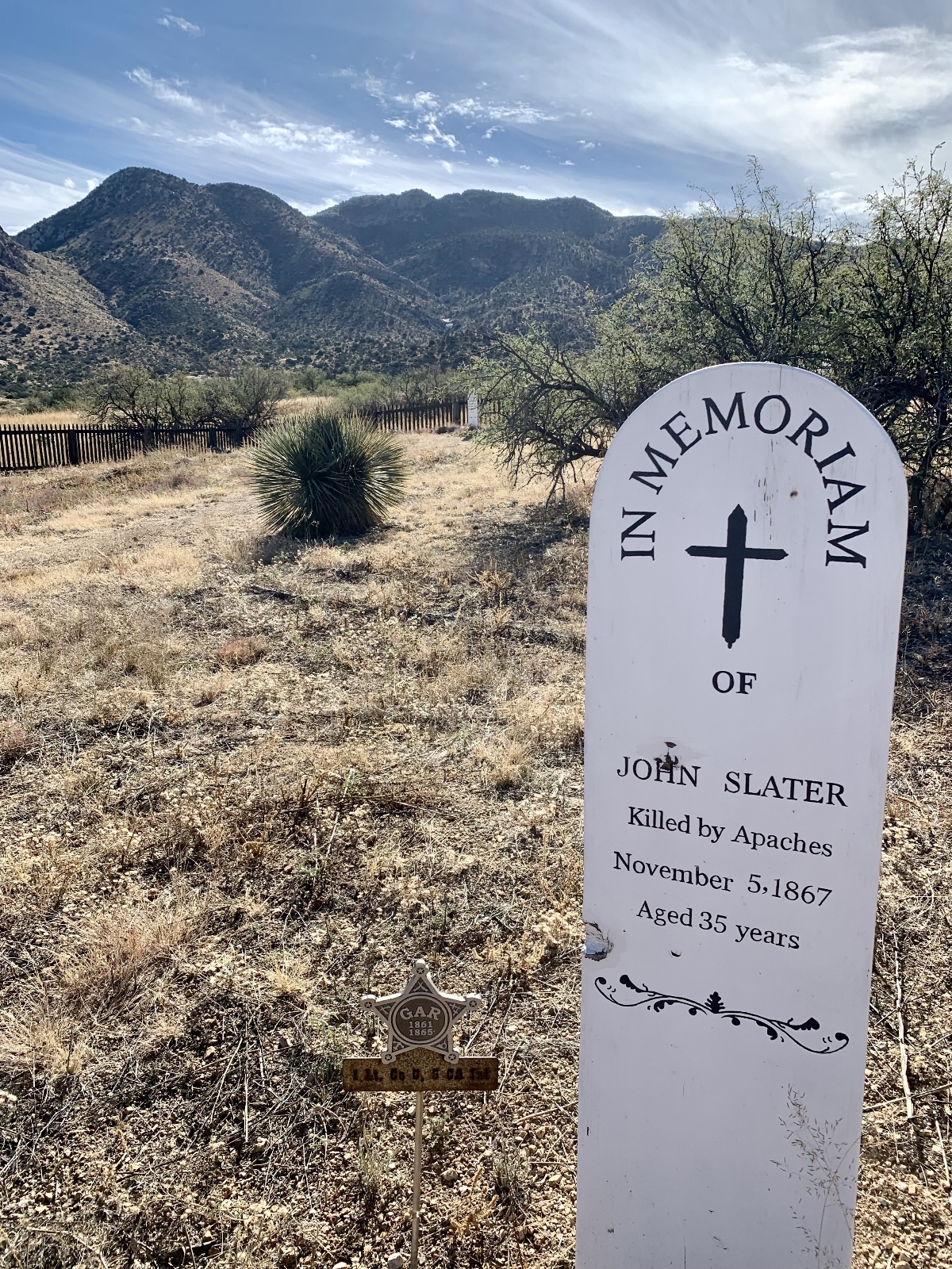
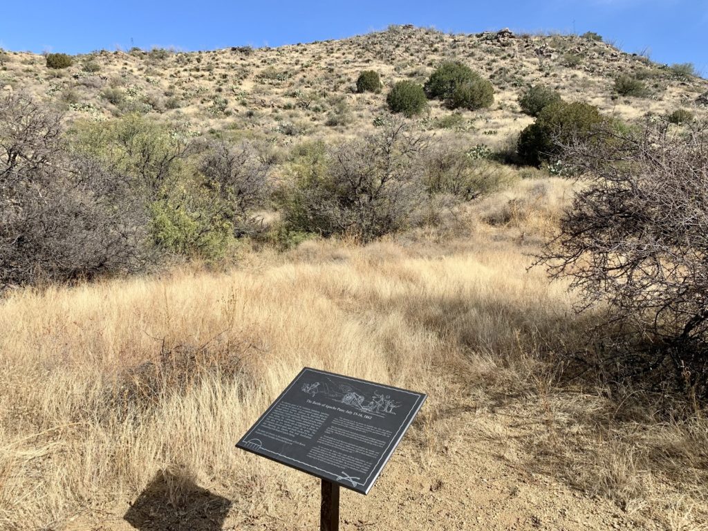
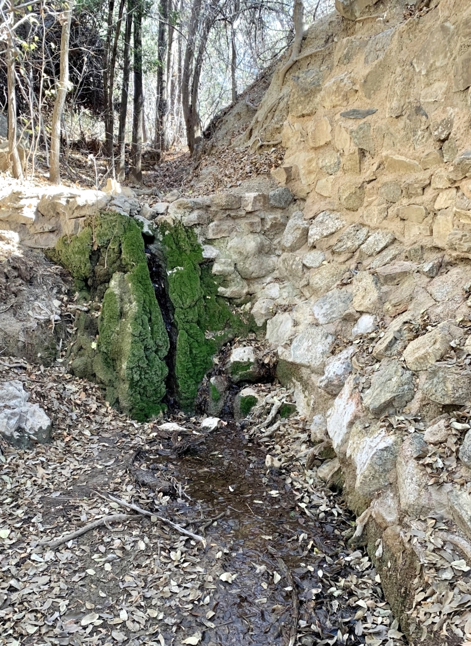
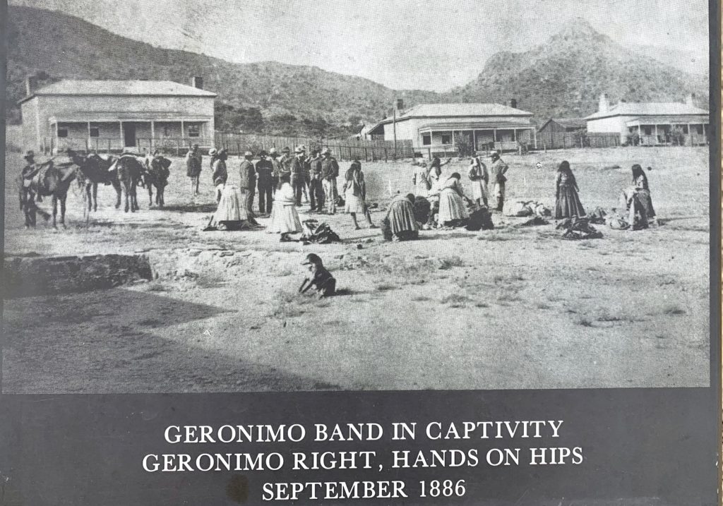
From 1849 to 1894, Apache Pass was a critical location for America’s westward expansion. The low divide which separates the Dos Cabezas Mountains from the Chiricahua Mountains contained three critical elements for travelers and their animals as they crossed the seemingly barren landscape of southern Arizona and New Mexico—wood, water, and grass. An emigrant trail first passed through beginning in 1849 during the California Gold Rush. In 1858, Congress authorized a transcontinental overland mail route which lead to the development of the Butterfield Overland Trail which crossed Apache Pass. One little problem. This was Chiricahua Apache land—home to great warriors and leaders Cochise and Geronimo. The Apache had recognized the importance of Apache Spring long before the arrival of those emigrating west. Tensions grew and from 1861 to 1886 the pass was the the site of continued conflict between the Chiricahua Apache and the US army leading to the establishment of Fort Bowie to protect travelers along the Butterfield Overland Trail and control the route.
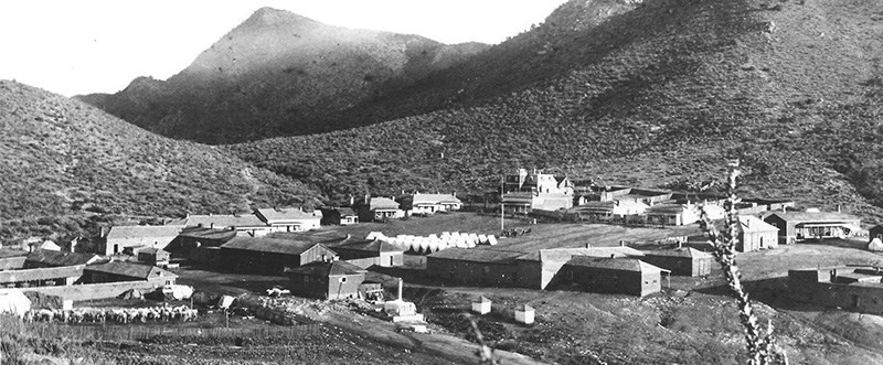
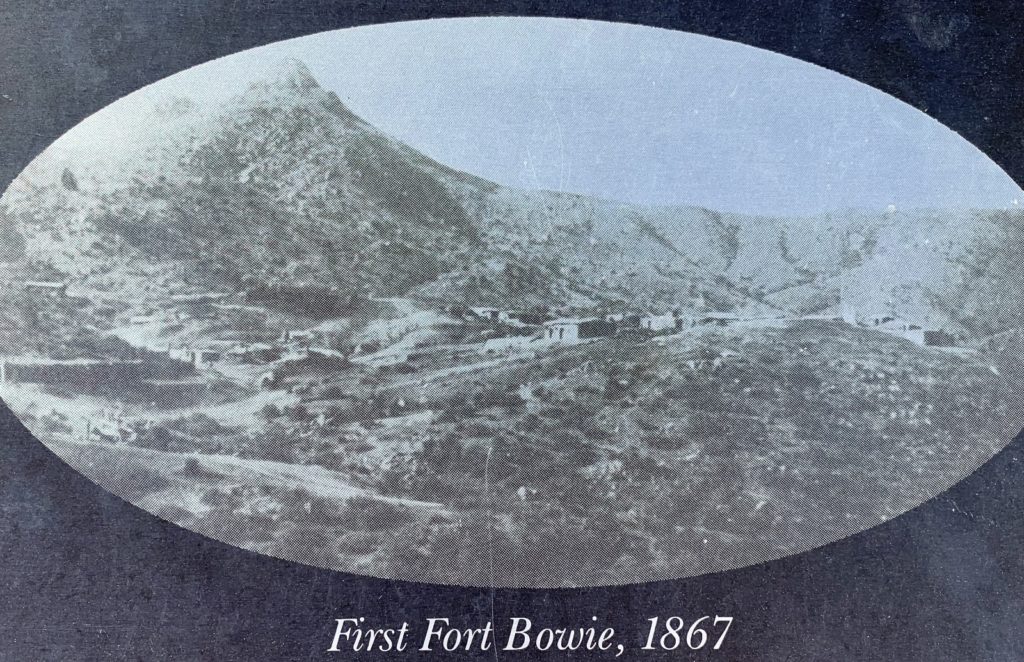
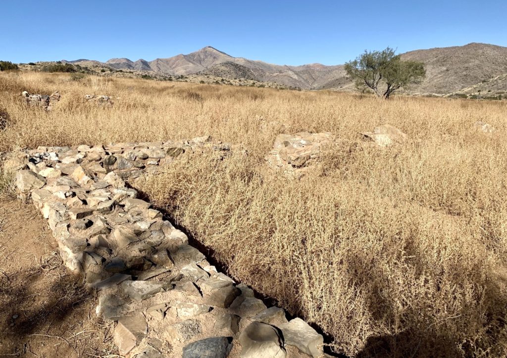
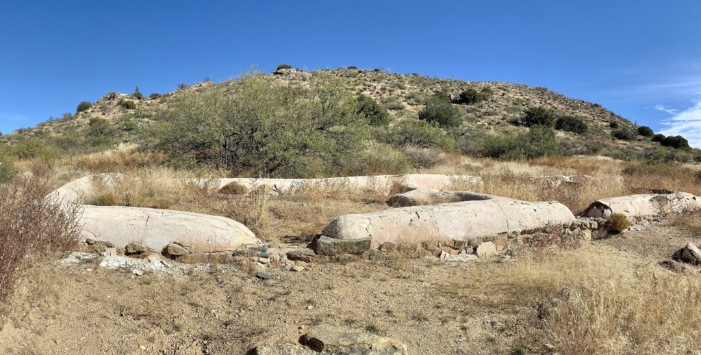
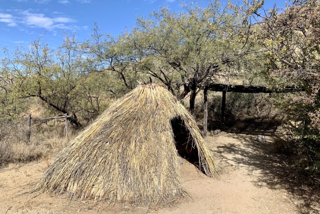
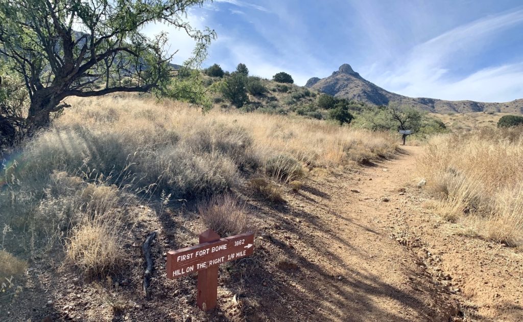
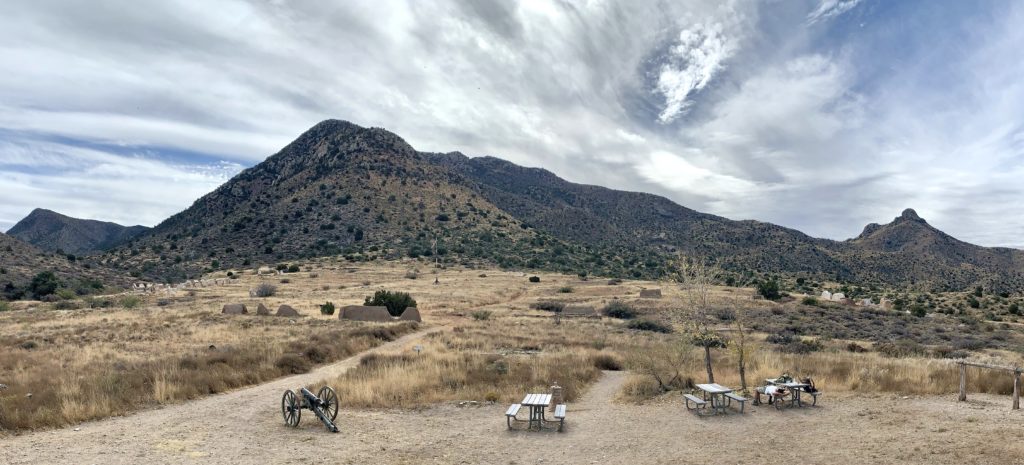
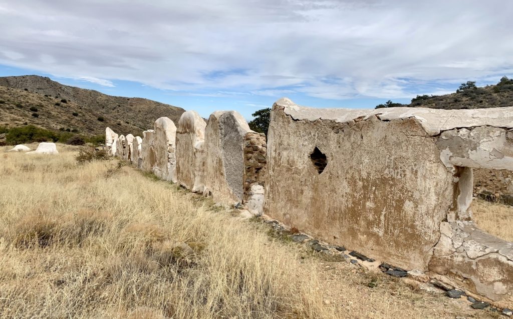
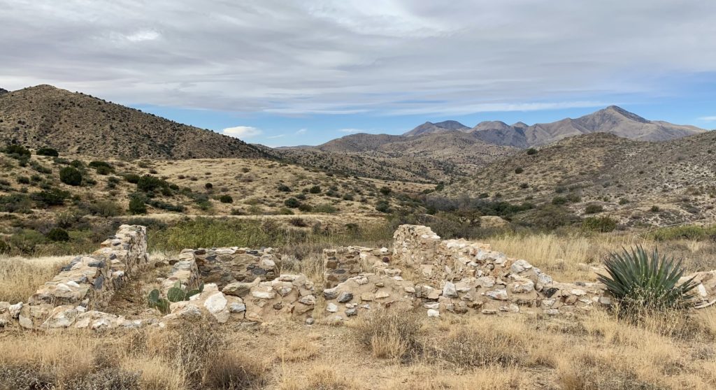
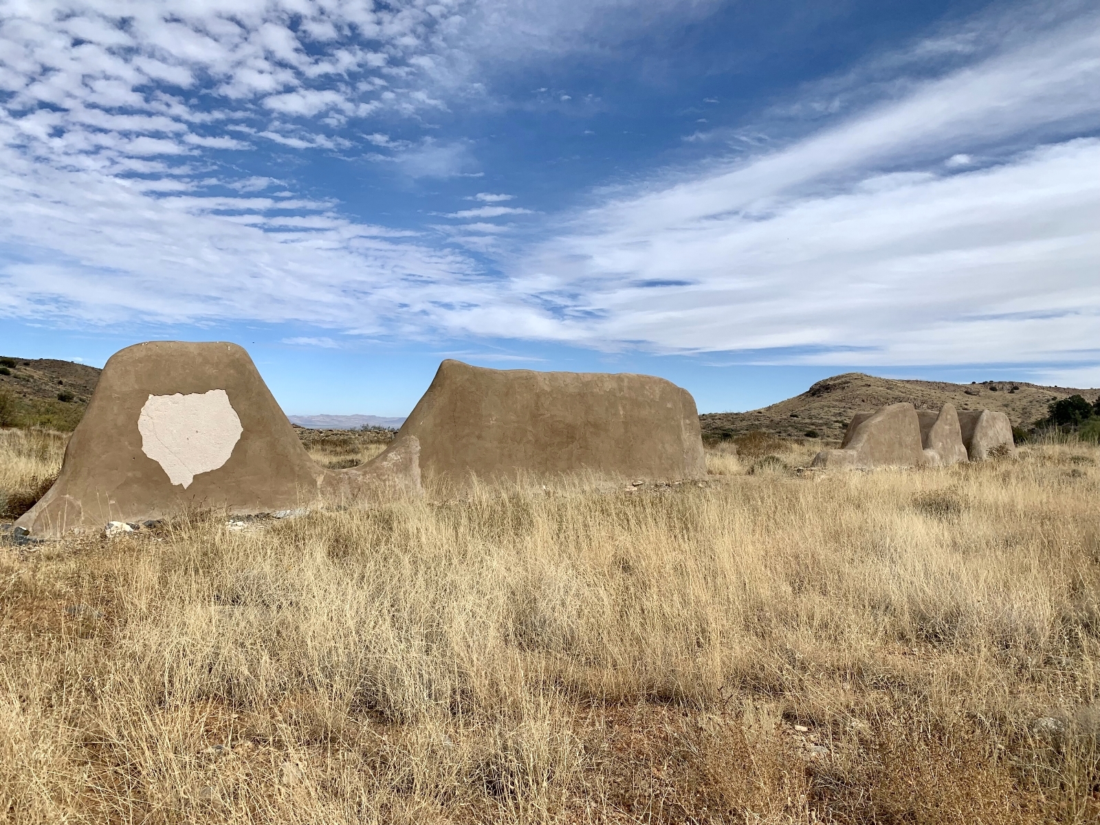
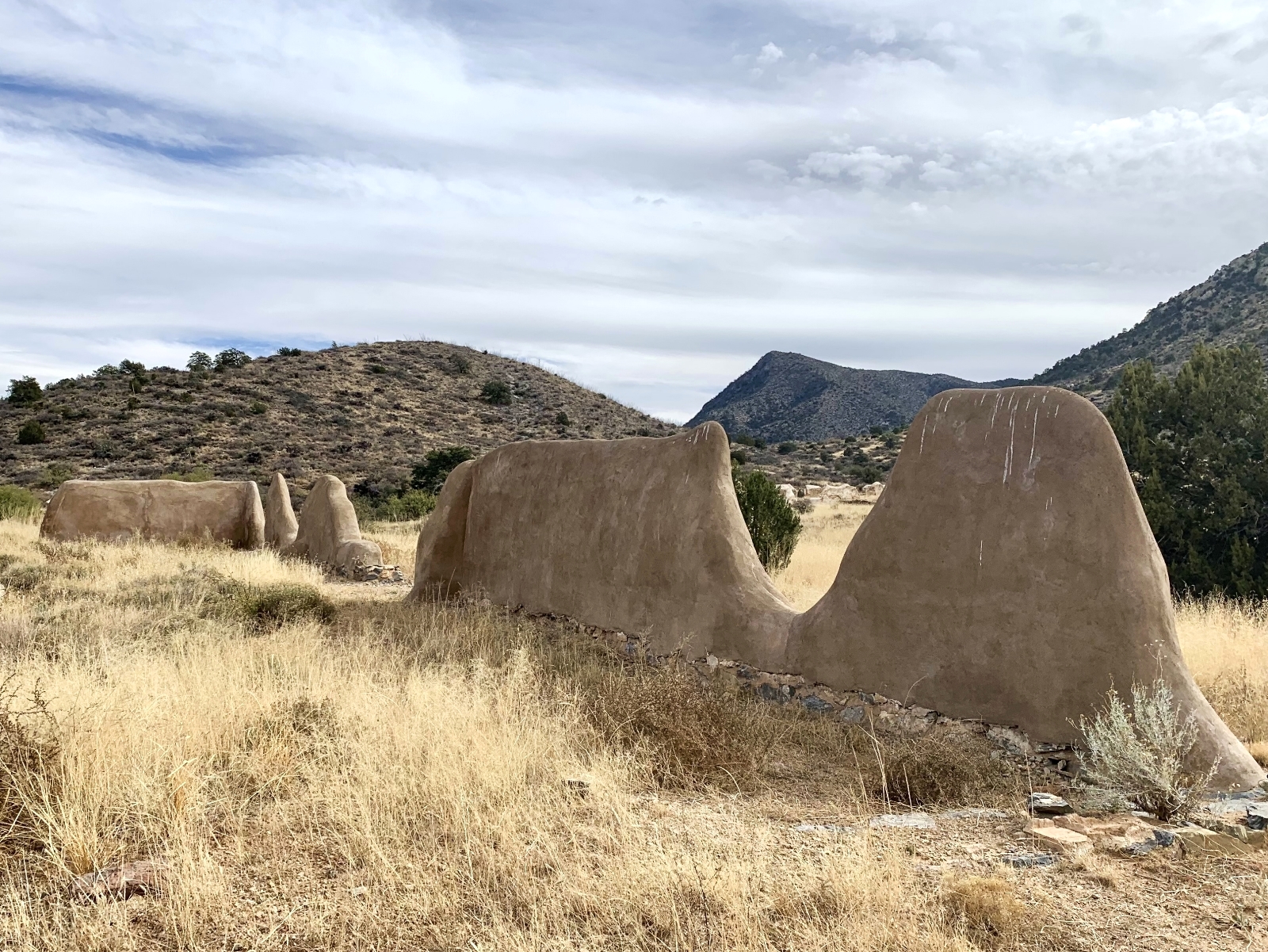
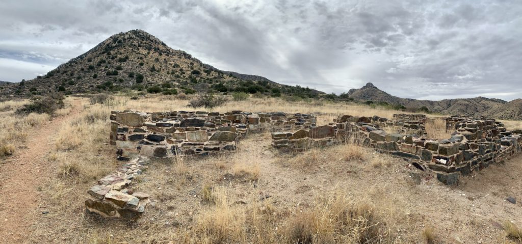
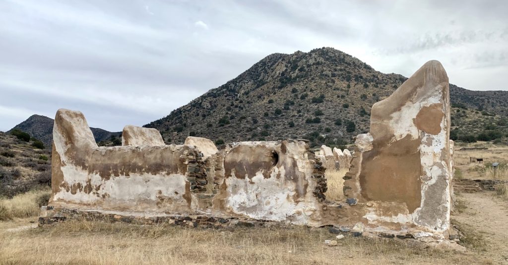
In July 1862, a 100-man detachment of the 5th California Volunteer Infantry began construction of the first Fort Bowie. The primitive fort was completed in just two weeks and was comprised of a four foot high stone wall surrounding tents and a stone guard house. The commander was ordered “to attack the Apaches whenever he finds them near his post, to escort all trains and couriers through the pass and well out into the mesa, and to take the liberty of sending out detachments strong enough to give protection to soldiers and killing when he deems it wise to do so.“ The Apaches continued to raid travelers not escorted by the military and sporadic patrols pursued the Apaches with little success. In 1866, regular soldiers relieved the volunteers and in 1868, construction was finished on the second Fort Bowie.
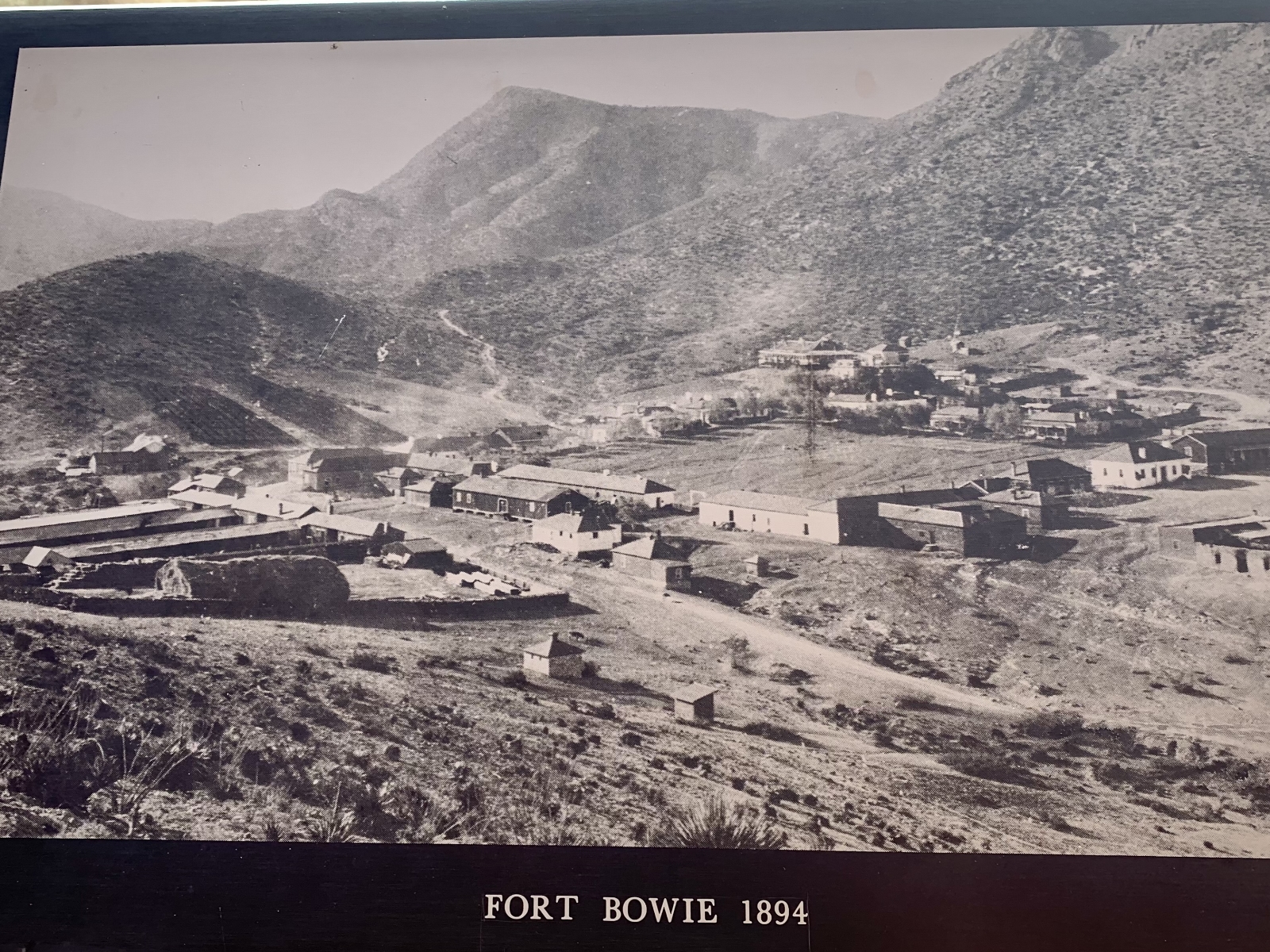

Cavalry escorts for travelers, mail couriers, and supply trains were common throughout the 1860s. In 1872, the US government reached peace terms with the Apache and Fort Bowie enjoyed several relatively peaceful years. Activity increased in the late 1870s as more soldiers were sent to pursue Apaches fleeing the San Carlos Reservations. Operations decreased again after Geronimo’s final surrender in 1886 and the last of the garrison left Fort Bowie in 1894. By the early 20th century, most traffic flowed across the Southern Pacific Railroad to the north and Apache Pass was all but forgotten as a travel corridor. The wagon road, trails, and fort buildings eroded for nearly a century until Fort Bowie National Historic Site was established in 1972.
Hiking to Fort Bowie
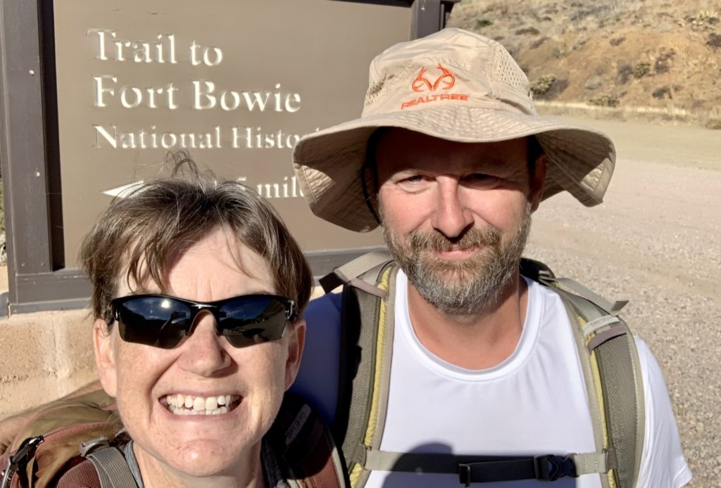
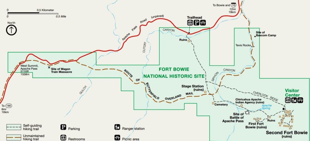
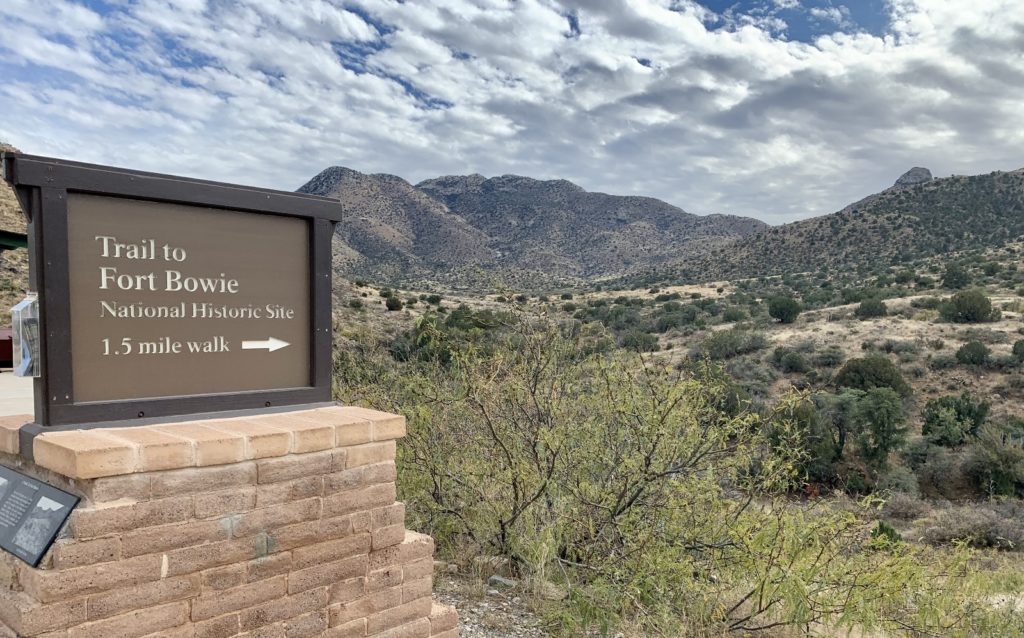
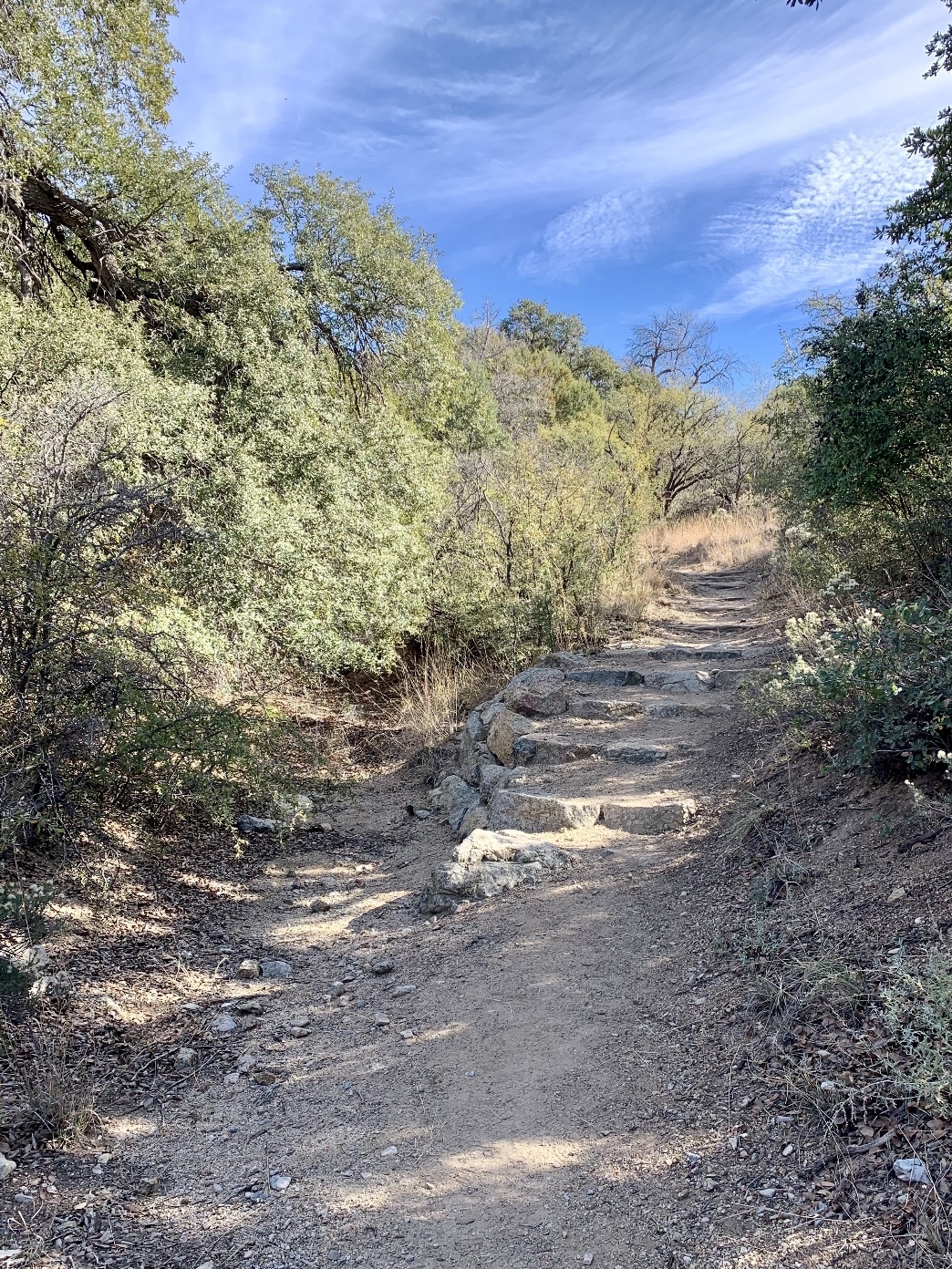
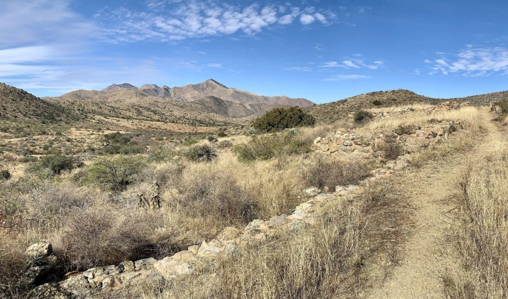
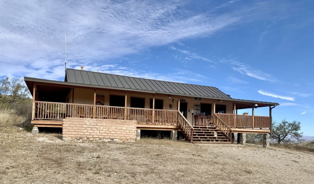
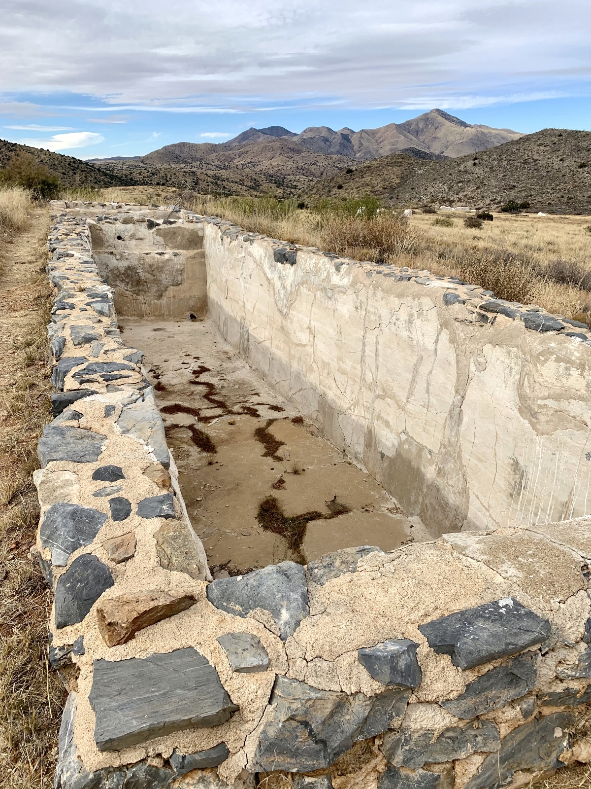
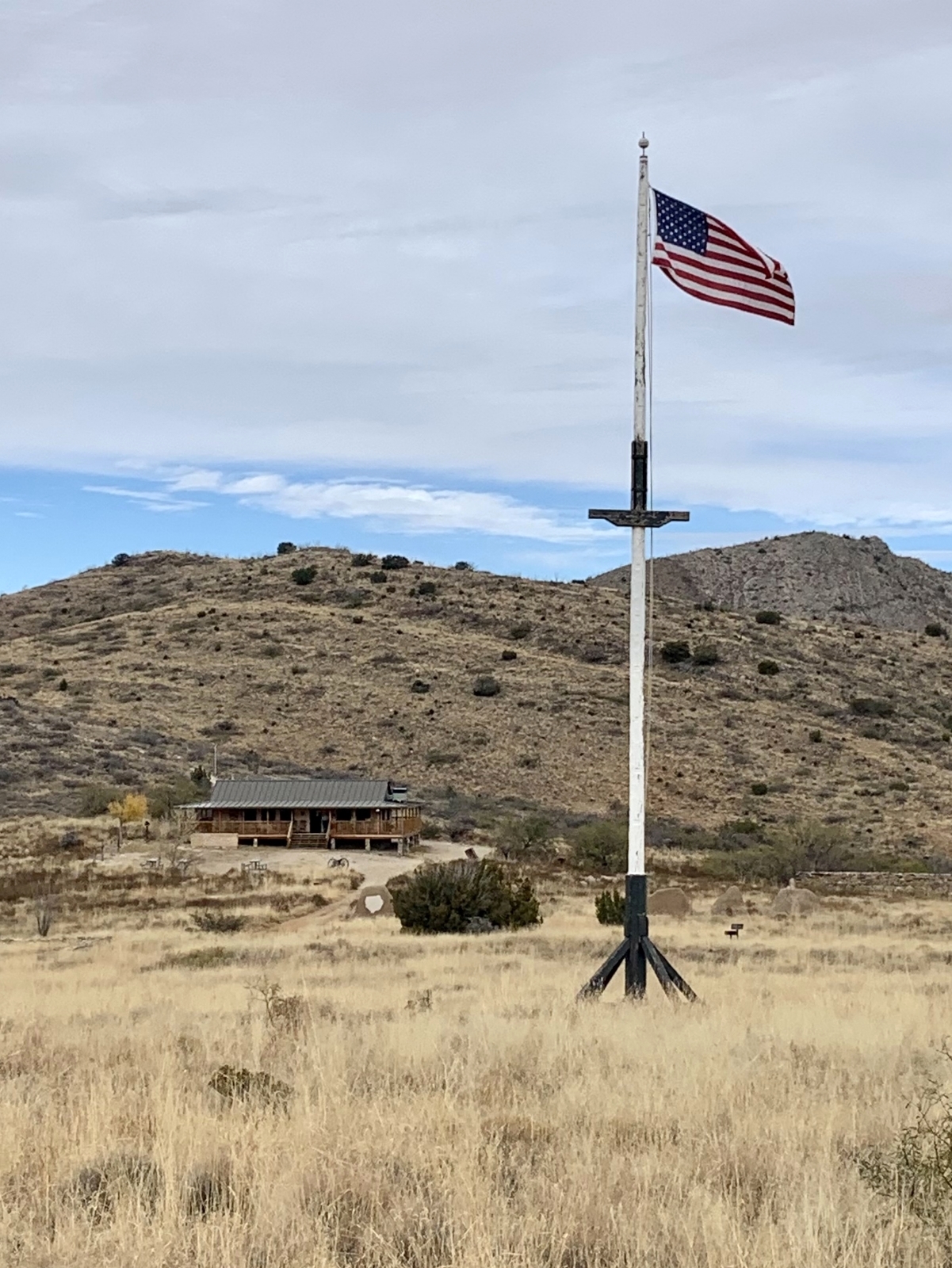
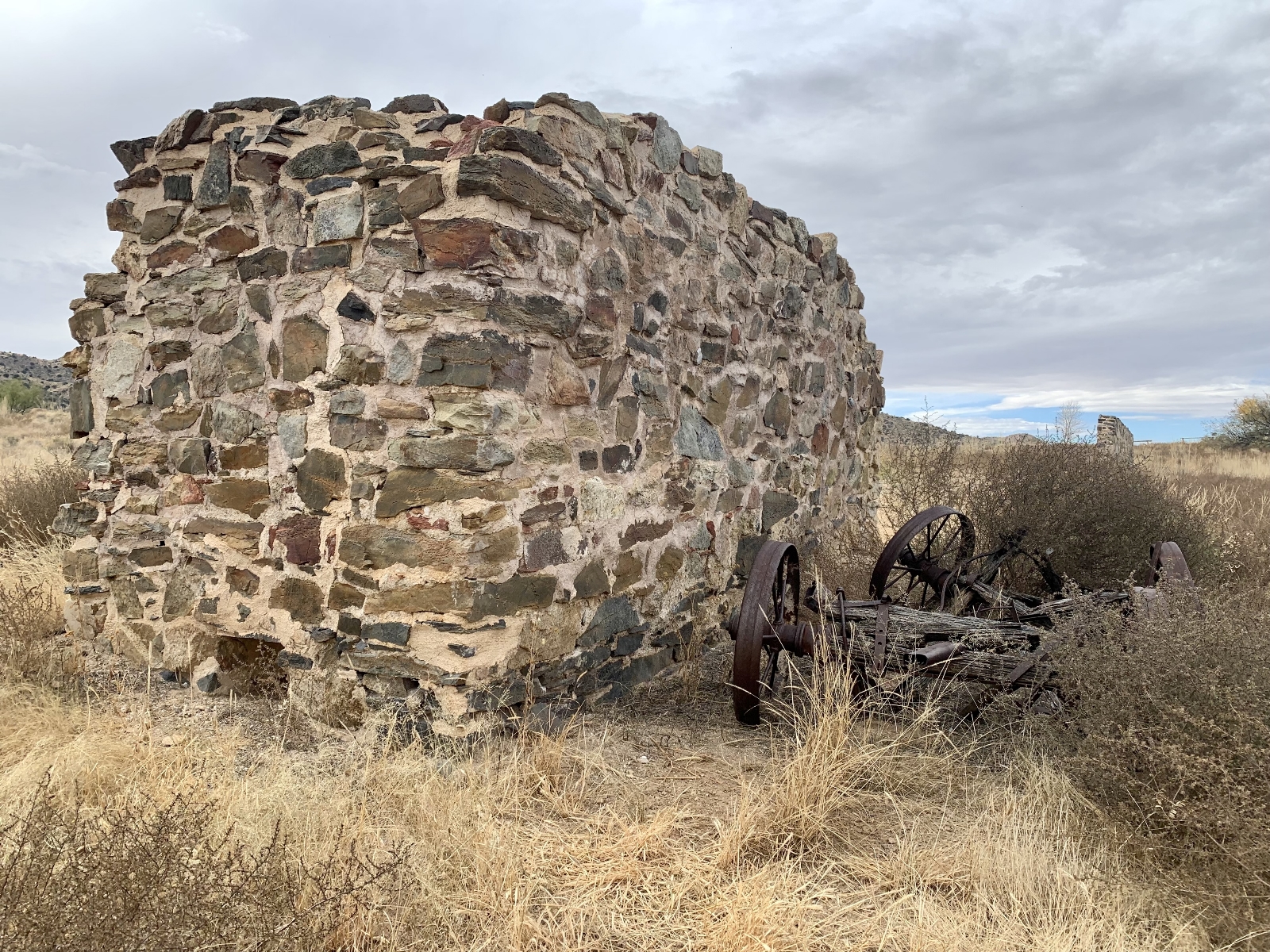
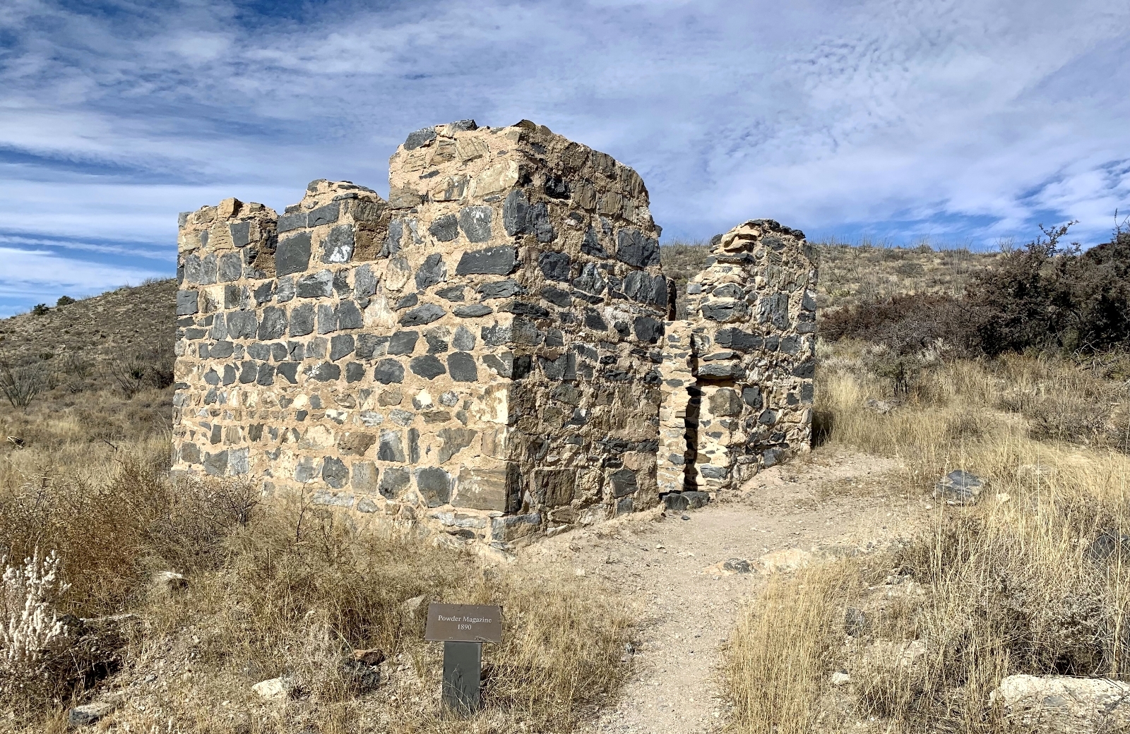
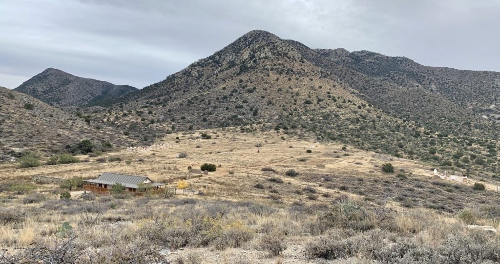
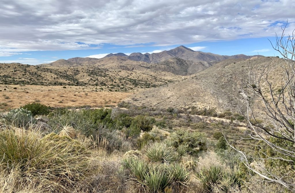
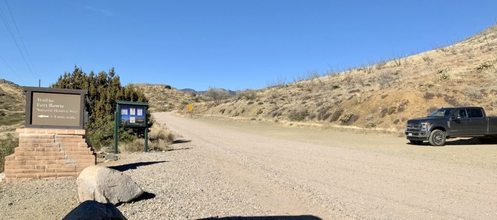
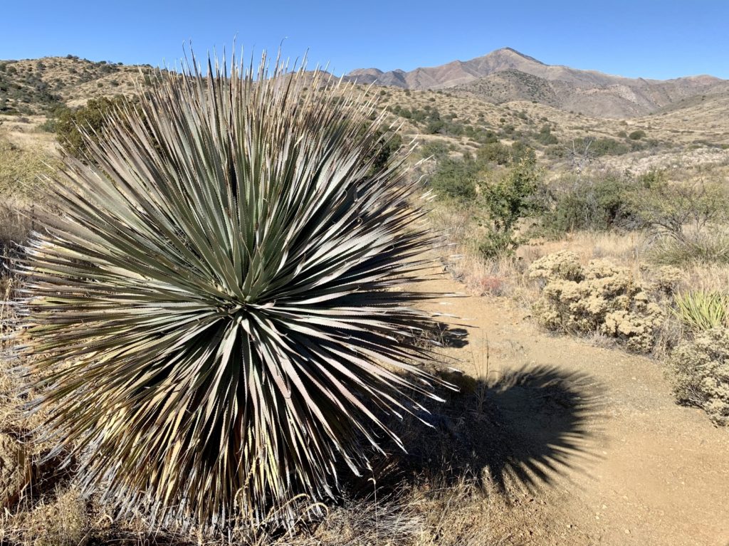
Today, traveling to Fort Bowie is similar to how it was 170 years ago—nonmotorized. Visitors arrive at the National Park Unit to find themselves sitting in a gravel pull-out along a dirt road in a remote corner of Arizona. From there, one must travel to Fort Bowie on foot along a well-worn trail. The park rates the 3 mile roundtrip hike as moderate with just under 200 feet elevation gain over uneven terrain. Along the way visitors travel through a beautiful valley past multiple historical sites, Apache Spring, and first Fort Bowie ruins before finally arriving at the visitor center and second Fort Bowie ruins. The visitor center is accessible to those with mobility limitations. See below for directions to the ADA parking lot.
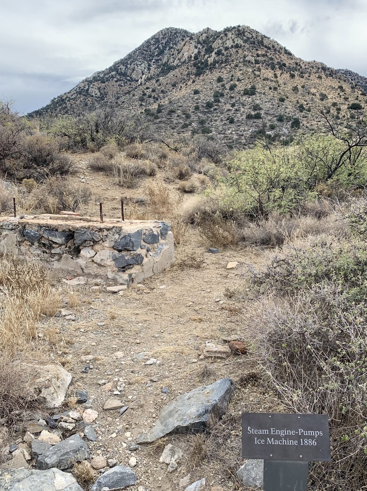
It took us just over three hours to visit Fort Bowie National Historic Site. All the other visitors that we saw took less time, but none of them took the side trails to the fort ruins. We stopped and read every interpretive sign, took every side trail (including the loops around each fort area), visited with the park volunteers at the visitor center, had a snack break, and hiked the optional Overlook Ridge Trail (see description below). In total, we hiked a total of 5.3 miles roundtrip. I recommend allowing yourself half a day to visit Fort Bowie at a leisurely pace. Here is a photo tour of our hike:
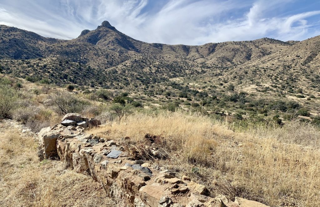
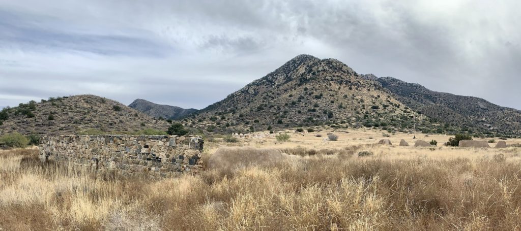
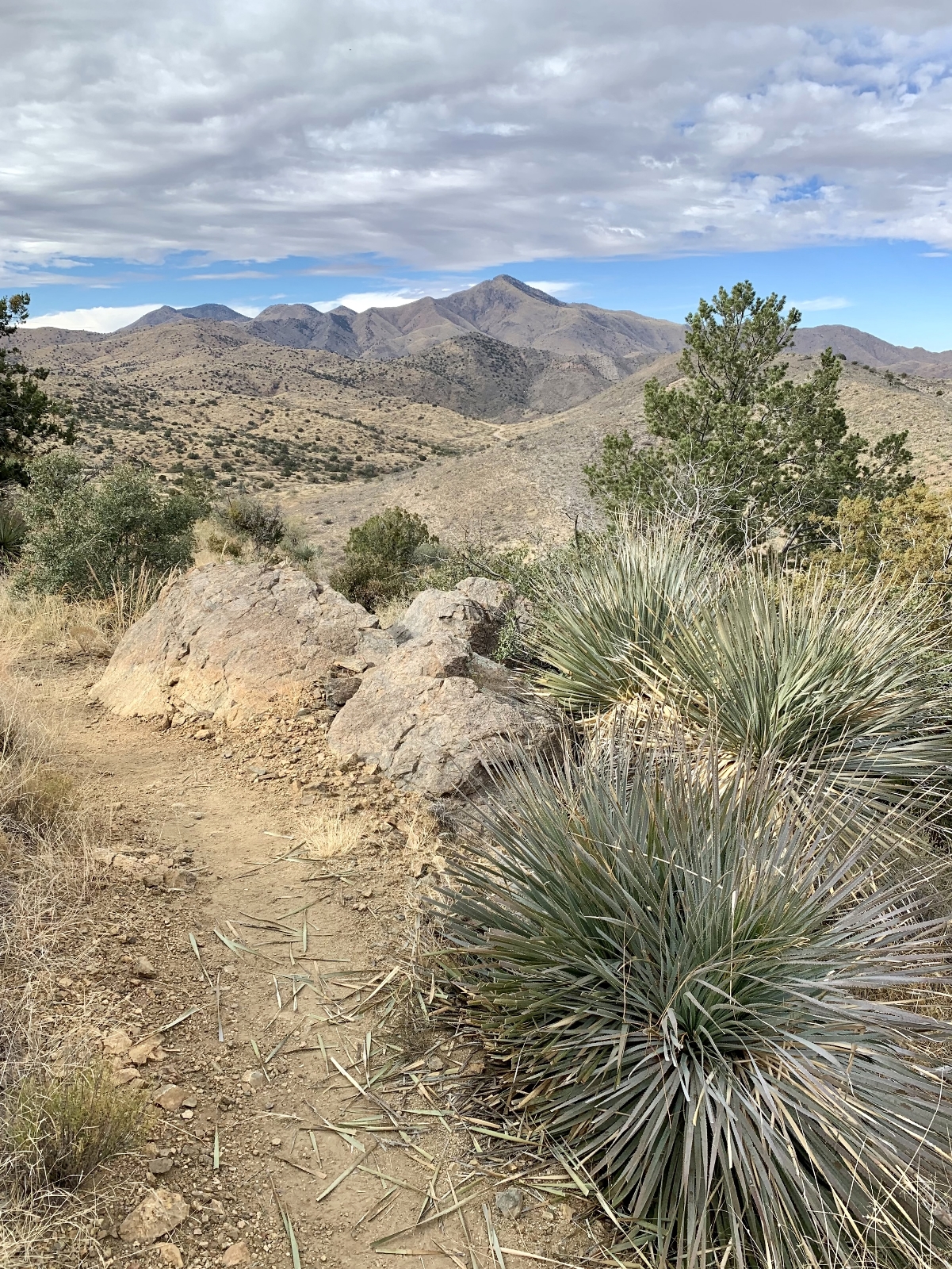
Most people return to their car via the main trail from the visitor center, but those up for a slightly more strenuous hike are encouraged to return via the Overlook Ridge Trail that starts behind the visitor center. This trail climbs to the top of a ridge providing panoramic views of Fort Bowie and Apache Pass before descending into Siphon Canyon and rejoining the main trail.
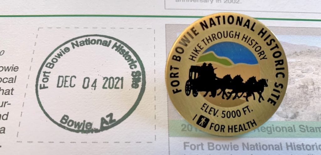
While at the visitor center, be sure to ask about the I Hike for Health program. All the Southern Arizona National Park Units offer this fun program to encourage visitors to get out and hike. Each park has its own challenge. Those hikers meeting the challenge requirements earn a park specific pin with unique design and motto. To qualify for the Fort Bowie pin, each visitor must hike a minimum of 3 miles in the park—basically, from the parking area up to the visitor center and back. Each individual seeking the reward must have a photo or selfie of themselves on each trail hiked and present the pictures to park staff at the visitor center. The Fort Bowie Hike Through History pin was our first pin earned and we had a lot of fun collecting the complete set during our winter travels.
Logistics
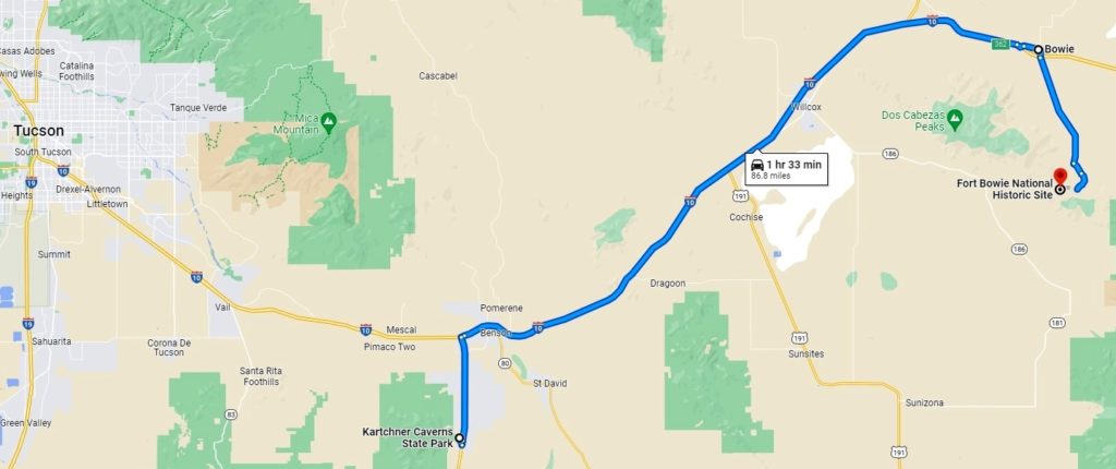
The park is 116 miles east of Tucson, AZ via I-10. From Willcox, AZ along I-10, drive 23 miles east of Willcox on Interstate 10 to the the town of Bowie. Exit at the first Bowie exit and drive through the town. Follow the signs for Fort Bowie National Historic Site and turn south on Apache Pass Road. Drive 13 miles to the well-signed Fort Bowie Trailhead (the last mile of the road is unpaved). The visitor center is open 7 days a week, 8:30 am – 4:00 pm Mountain Standard Time every day of the year except Christmas Day (note: Arizona does not observe Daylight Savings Time). Park and trails are open every day from sunrise to sunset. Admission is free!
For those with mobility limitations, follow the directions above, but look for the ADA accessible icon signs from Apache Pass Road. Passenger vehicles can travel South Old Fort Bowie Road until it dead-ends in a small administrative area at Fort Bowie NHS. From the ADA parking lot, visitors follow a trail that is 500 feet in length and ascends approximately 80 feet in elevation to reach the visitor center at the edge of the second fort ruins. If unable to climb the steps, visitors can arrange to have a gate opened that allows them to drive a vehicle to the visitor center and unload wheelchair users or other folks with limited mobility. Because this method traverses fragile park resources, it is reserved as a limited option for those folks that are unable to visit the fort ruins without it. Contact the visitor center staff at 520-847-2500, ext. 25, for more information on accessing Fort Bowie NHS.
Safety
Fort Bowie is at moderately high elevation (5,000 feet), in a desert environment, close to the US-Mexico border. The park recommends following these tips to ensure that you have a fun and safe experience.
- Altitude and elevation changes can make any length of hike more difficult.
- There is little to no cell phone reception in the area.
- Keep a respectful distance from all wild animals. Be alert for rattlesnakes.
- Check the weather—summer temperatures may climb above 100 degrees. Summer storms may suddenly and briefly flood the washes. Avoid hiking when lightning is present.
- Take plenty of water. Plan to drink at least 1 quart/hour, especially in the summer. Drinking water is available at the visitor center, but not at the trailhead.
- Follow these guidelines for hiking near the border: know where you are at all times, follow good safety procedures, and use common sense when making decisions. Do not pick up hitch-hikers. Keep valuables, including spare change, out of sight, and lock your vehicle. Avoid traveling on well-used but unofficial “trails.” People in distress may ask for food, water, or other assistance. It is recommended that you do not make contact. Report the location of the distressed people to the visitor center, other park staff, or the Border Patrol. Report any suspicious behavior.
It is worth noting that we had zero problems during our visit to Fort Bowie and we saw nothing suspicious. We always remain alert and aware of our surroundings during our hikes, regardless of where we are. We felt very safe at Fort Bowie and highly recommend a visit there (following the park’s recommendations, of course).
The Adventure Continues
Be sure to join us for our next post as we ‘rock the rhyolite’ at nearby Chiricahua National Monument. And don’t forget to check out our Amazon RV and Adventure Gear recommendations. We only post products that we use and that meet the Evans Outdoor Adventures seal of approval. By accessing Amazon through our links and making any purchase, you get Amazon’s every day low pricing and they share a little with us. This helps us maintain this website and is much appreciated!
Very interesting! I enjoyed the the descriptions and the many pictures!
Glad you enjoyed! 🙂